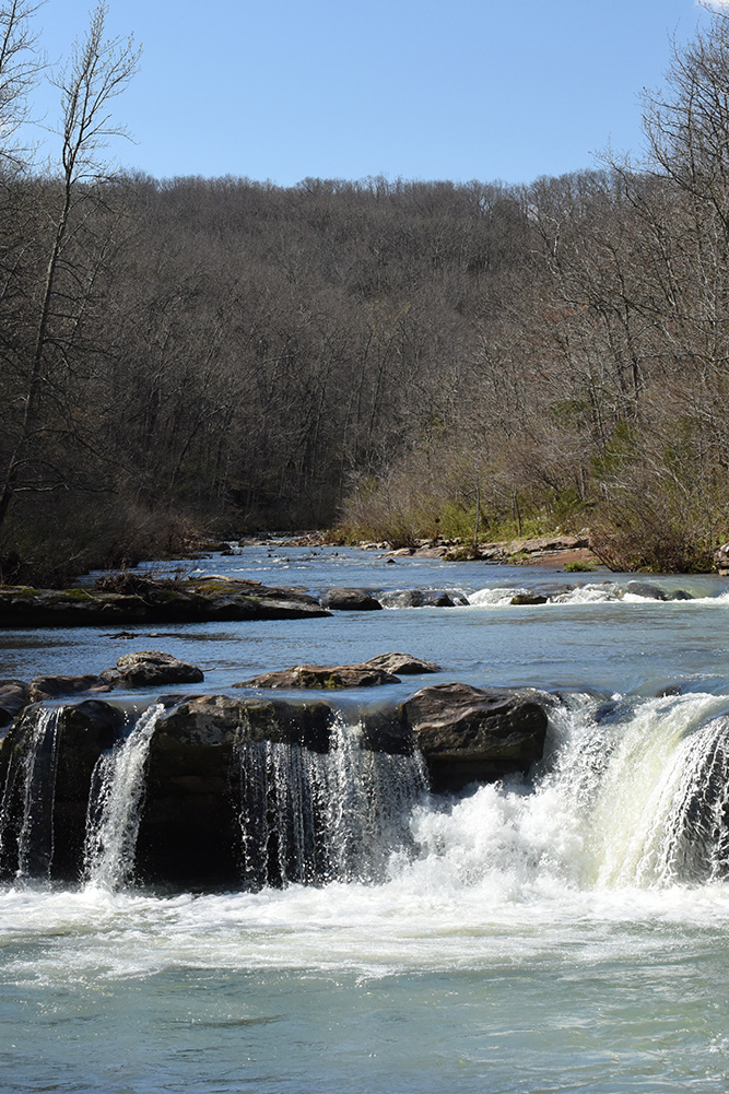
Kings River Falls Natural Area is located at the interface of the Springfield Plateau and Boston Mountains subdivisions of the Ozark Mountains. The natural area includes more than 3 miles of the Kings River with Kings River Falls being a focal point. Kings River is a clear mountain stream originating east of Boston in Madison County. The river flows for about 50 miles through Madison and Carroll Counties, eventually merging with Osage Creek before it flows into Table Rock Reservoir. A mixed hardwood forest covers the slopes and ridges of the natural area, with scattered pockets of shortleaf pine. Steep rocky slopes, sandstone bluffs, and rocky banks characterized the corridor along the river. A diverse and colorful shrub community borders the stream.
TRAIL
Length- 2 miles roundtrip
Difficulty- Easy to moderate; not ADA accessible
Trail Blazes- Blue
Download Trail Map
This is an in-and-out trail that begins and ends at the parking area. It parallels Mitchell Creek, a tributary, for the first 0.1 mile. The trail then turns north and parallels the Kings River. Hikers will cross one small bridge roughly 0.5 mile in. The highlight of this hike is the scenic Kings River Falls. This river is relatively unique for the Ozarks because it flows from south to north.
DIRECTIONS
From the community of Boston on State Highway 16 (between Fallsville and St. Paul), go north on County Road 3175 (dirt) for 2.1 miles; bear right as the road forks onto County Road 3415. Stay on this road for 2.3 miles until you come to a "T" intersection with County Road 3500. Turn left, and go across the creek and park at natural area sign.
HUNTING
Specific types of hunting are allowed on this natural area. For details, see the Ozark National Forest WMA listing in the current Arkansas Hunting Guidebook. Take all necessary safety precautions when visiting this area.