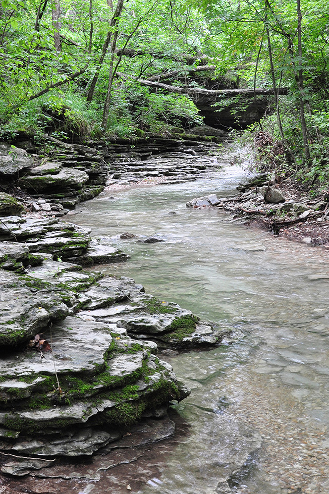
Devil's Eyebrow Natural Area is located at the northern end of Beaver Lake along Indian Creek and its tributaries. The terrain is rugged and steep, consisting of deep, bluff-lined hollows separated by steep ridges. Much of the area is underlain by alternating layers of chert and limestone that include caves and many springs. Plant communities are diverse and include high quality glades, woodlands, bluffs, rich hardwood forests, and riparian forests. Devil's Eyebrow supports one of the highest concentrations of rare plant species in Arkansas with several species typically found far to the north and others that are restricted in distribution and considered globally rare. The Arkansas Game and Fish Commission (AGFC) and the Arkansas Natural Heritage Commission (ANHC) share undivided fee title and co-manage this natural area.
TRAIL
Length- 11.8 miles roundtrip
Difficulty- Strenuous
Download Trail Map
This nature trail mostly follows old logging roads that meander through steep topography characterized by streambeds, ridges, and ravines. Visitors can enjoy a scenic spring that flows year round about 1.5 miles from the parking area. The varying layers of bedrock can be seen at several places along the trail. In the fall and winter Beaver Lake can be seen from the top of Trimble Mountain. There are spur trails off the main trail: a north spur trail (0.35 mile), a middle spur trail to the top of Trimble Mountain (0.3 mile), a south spur trail to Beaver Lake (1 mile), and a loop trail (1.4 miles) around the top of Trimble Mountain.
DIRECTIONS
From the town of Garfield, travel east on US Highway 62 for 4 miles to the community of Gateway. From the junction of Highway 62 and Highway 37 at Gateway, continue east on US Highway 62 for 0.5 miles to the entrance of the natural area (on the south side of the highway).
HUNTING
Related Content
- ANHC Recognizes ANAP Groups
- Panels at Devil's Eyebrow Natural Area Complete Trail
- Acres Added to Devil's Eyebrow Natural Area
- Partnership Benefits Two Agencies: Restoration of Prairies and Glades for Fish and Anglers
- Arkansans Value Space Outdoors -- Plan Helps Provide Access
- Dedication of Devil's Eyebrow
- Devil's Eyebrow Natural Area 2013 video