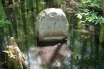
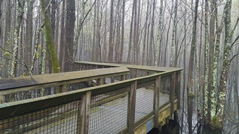
 The Louisiana Purchase State Park-Natural Area is named for its historic landmark, a monument that marks the “initial point” established November 10, 1815, by the first surveyors of lands of the Louisiana Purchase. The natural area is a cooperative project with Arkansas State Parks and features an interpretive boardwalk in the heart of the swamp, providing a view of the commemorative stone survey monument.
 In 1815, President James Madison ordered the U.S. government to survey the lands of the Louisiana Purchase. At the time of the survey, the land destined to become Arkansas was part of the Missouri Territory. The U.S. Land Office hired Prospect K. Robbins and Joseph C. Brown to conduct the survey by establishing an “initial point” in eastern Arkansas by which all other land surveys of the Louisiana Purchase would originate.
In the fall of 1815, Robbins and Brown arrived in Arkansas with several other men and at the St. Francis River, they divided their surveying group into two parts. Brown and his men landed at the mouth of the St. Francis River in present-day Phillips County while Robbins continued to the confluence of the Arkansas and Mississippi rivers in present-day Desha County. On November 10, the initial point was established after the men had worked for 14 days and traveled 55 miles. They marked the initial point by marking two sets of gum tree (known today as the witness trees) for the base line and the meridian. The initial point of survey is located at 91 degrees, 03 minutes, 42 seconds west of Greenwich and at latitude of 34 degrees, 44 minutes north.
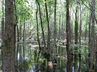
 This initial point and site of the commemorative marker is located in a headwater swamp, a unique type of swamp. Headwater swamps occur in ancient glacial outwash channels that are similar to shallow basins or bowls. These swamps are unusual because they are self-contained within these “bowls.” The headwater swamp at the Louisiana Purchase marker is dominated by bald cypress (Taxodium distichum) and water tupelo (Nyssa aquatica) but is not located along a stream or river. Instead, it comprises the headwaters of Little Cypress Creek, thus the name “headwater swamp.” With a small watershed and fed by groundwater seepage, the water levels of this swamp vary only a few feet throughout the year. Headwater swamps were common in the region at one time, but because such swamps are easy to drain, they are now rare. The headwater swamp protected within the natural area is one of the last and largest remaining in the Mississippi Alluvial Plain.
 Make plans to see the marker and learn more about the natural area at https://www.arkansasheritage.com/arkansas-natural-heritage/naturalareas/find-a-natural-area/louisiana-purchase-natural-area .
Photos:
Top — Monument marking the initial point of the Louisiana Purchase at Louisiana Purchase Historic State Park-Natural Area. Photo by ANHC staff.
Middle — Headwater swamp at Louisiana Purchase Historic State Park-Natural Area. Photo by Bill Holimon.
Bottom — Boardwalk into the swamp at Louisiana Purchase Historic State Park-Natural Area. Photo by Emily Roberts.
Main photo — Monument and headwater swamp at Louisiana Purchase Historic State Park-Natural Area. Photo by Bill Holimon.
